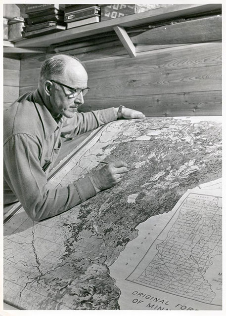
 The Trygg Historical Maps were developed by J. William Trygg (Bill Sr.) as a result of his work for attorneys representing several Native American Tribes from 1956 until his death in 1971.
Historical Maps of Minnesota, Wisconsin, Michigan, and Iowa
He prepared historical appraisals to establish values of the Tribes’ lands at the time the lands were ceded to the United States. The values were used in the Tribes’ claims to obtain adjustments of the amounts paid them when their lands were ceded.
Historical Maps Based on Pre-settlement Original US Surveys
Trygg Historical Maps are based on the Original Land Surveyors’ plat maps and field notes and show information from pre-settlement times of the Original Surveys. The maps show the nature of the land as it was when first surveyed for the United States. Features shown on the maps may include original wetland (swamp,) marsh, prairie, lakes, ponds, rivers, creeks, springs, sloughs, trails, roads, houses and buildings, Native American Villages and Sugar Camps, fields, and mill sites, as noted by the Original Land Surveyors in their plat maps and field notes. Original pine lands are shown on certain maps as indicated on the index. The year of the township survey (mid- to late-1800’s) is marked on some of the maps. Trygg Historical Maps are unique in that the information from the Original Surveyors plat maps and field notes are combined on one map.

Original instructions to the Land Surveyors of the Historical Maps
“Your field notes are to form a full and perfect history of your operations in the field. You are to enter in their proper places in the field notes of your survey, a particular description and the exact location of the following objects:–
- The length and variation or variations of every line you run.
- The name and diameter of all bearing trees, with the course and distance of the same from their respective corners.
- The name of the material from which you construct mounds, with the course and distance to the pits.
- The name, diameter and exact distance to all those trees which your lines intersect.
- At what distance you enter, and at what distance you leave every river, creek or other “bottom”, prairie, swamp, marsh, grove or windfall, with the course of the same at both points of intersection.
- The surface, whether level, rolling, broken or hilly.
- The soil, whether first, second, or third rate.
- The several kinds of timber and undergrowth, naming the timber in the order of its prevalence.
- All rivers, creeks and smaller streams of water, with their actual or right angled widths, course, banks, current and bed, at the points where your lines cross.
- A description of all bottom lands–whether wet or dry, and if subject to inundation, state to what depth.
- All springs of water, and whether fresh, saline or mineral, with course and width of the stream flowing from them.
- All lakes and ponds, describing their banks and the depth and quality of their water.
- All coal banks, precipices, caves, sink holes, quarries and ledges with the character and quality of the same.
- All water-falls and mill sites.
- All towns and villages, houses, cabins, fields and sugar camps, factories, furnaces and other improvements.
- All metalliferous minerals or ores, and all diggings therefore, with particular descriptions of both, that may come to your knowledge, whether intersected by your lines or not.
- All roads and trails, with the courses they bear.
- All offsets or calculations by which you obtain the length of such parts of your lines as cannot be measured with the chain.
- The precise course and distance of all witness corners from the true corners which they represent.”