Creator of Composite Maps of the United States Land Surveyors’ Original Plats and Field Notes
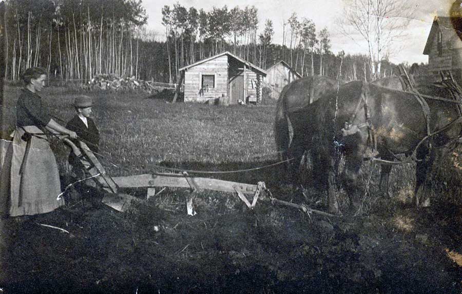
J. William (Bill Sr.) Trygg was born in 1905 in Cook, Minnesota and was the oldest of 11 children. His parents, John and Kaisa Trygg, were Swedish immigrants and among the first pioneers in the Cook area. Their farm was carved out of the dense forests and meadows on their homestead on the Rice River.
Bill started first grade at age seven and walked two miles to school, the first mile by himself, before being joined by several Finnish speaking children, from whom he learned some basic Finnish.
After completing 8th grade, Bill worked the next year on the family farm and in a logging camp. When 9th grade was offered in Cook the following year, Bill returned to school for two years to take 9th and 10th grades. Since the Cook school only went through 10th grade, he worked a season as a clerk in a logging camp to help pay for room & board in Virginia where he completed his last two years of high school. Mechanical drawing led to part time work for a local architect after school. After one year of forestry courses at Virginia Junior College he worked in land surveying, road construction, logging, lumber scaling, and other related jobs.
In 1926 Bill began working for the U.S. Forest Service. He liked to recall his early experiences, one of which was spending the winter of 1931-32 living and working in a remote area of the Superior National Forest, near the Canadian Border. He and three other young men, Arvid Tesaker, Don Kelsey, and Ed Larson, traveled by snowshoe and hauled all of their supplies; food, shelter, and gear on toboggans. On the first day they traveled 12 miles and set up camp, a primitive shelter of logs and canvas. They walked out earlier than planned in late February because one of the men had walked through the soles of his boots.
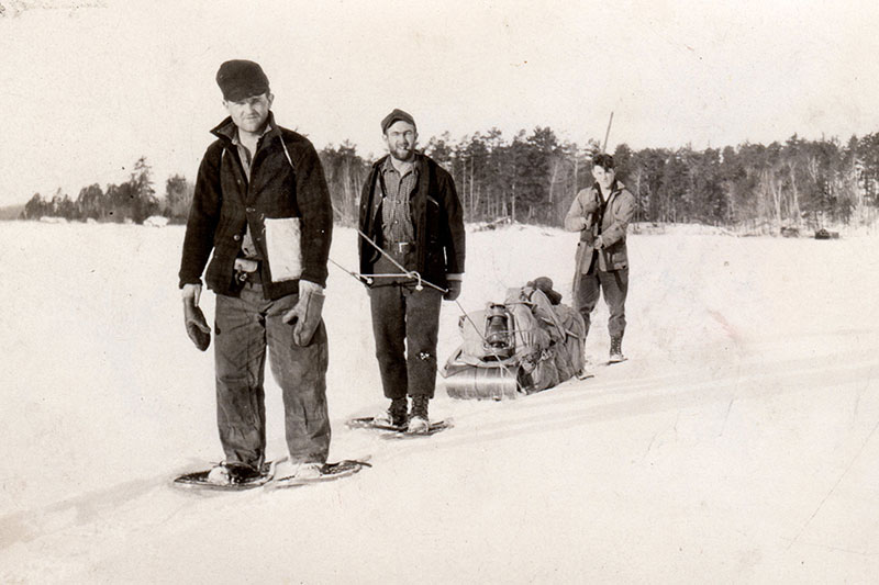
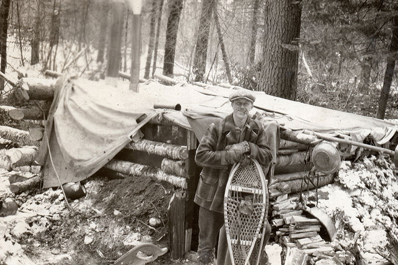

From correspondence between Bill Trygg and Arvid Tesaker in 1966, Bill writes ” I have thought of you many times and the great experiences we had. I’ve told the story of Ed Larson walking out of his boots (rubber pacs) and being fired because we came in because of it! Labor relations! I hope you can get up here next summer – we ought to visit the two lakes named after us & check out a few M.C.’s” (Meander Corners)


With hands on experience and courses over many years, Bill became a Professional Forester. During his time with the Forest Service he served in a variety of capacities and was in charge of Civilian Conservation Corps (CCC) camps in the Ely area in the 1930’s.
Bill was considered one of the pioneers of the aerial photo system set up in 1935 for inventorying and classifying timber and forest lands. This system was used to map fires and damage to trees from insects and diseases, as well as aid in locating trails, portages, roads and railroads in the forest. He appreciated the advantages planes gave in scouting fires and mapping blazes.
Bill was the Kawishiwi District Ranger in Ely from 1942 until his disability retirement in 1954. As District Ranger, he had charge of the Central Fire Control Equipment Service Center serving the Superior National Forest.
Work with the Forest Service had taken Bill by canoe through all the inland lakes, by foot across country cruising timber and fighting fires, as well as flying over it. He had seen the remnants of the original forest stands and was interested in learning more about their extent and when, how, and by whom they were logged.
In 1955 Bill started his own business and offered forestry consulting, real estate, and appraisal services (Trygg Land Office.)
He presented a program on early logging in northern Minnesota to a group in Duluth. One of the members, Rod Edwards an attorney in Duluth whose firm was hired by various Native American Tribes, asked if he would be able to determine the original logging areas in north-central Minnesota and the amount and value of the timber there in 1855. Bill accepted the challenge and developed a system to appraise lands as of the date of cession for the tribes’ lawsuits against the United States. This led to appraisals in Minnesota, Wisconsin and Michigan in order for the tribes to obtain adjustments to what had been paid when their lands were ceded (often 100 years before.)
The work involved a dedicated team of employees who gathered and analyzed historical data to produce the valuations, reports and exhibits for testimony before the Native American Claims Commission in Washington. D.C.
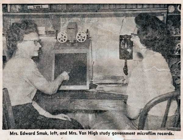
Rolls of microfilm of the original surveyors’ field notes were read by one person and recorded by another onto copies of the Original Survey maps. Layers of related information were drawn all at once; for example, all structures were drawn at one time. 30,000 pages of survey notes were each read multiple times abstracting different data each time.
Dr. Stephen Kapsch, who was a college student when he worked for Bill in 1960, wrote in 2010 about reading the rolls of microfilm; “Those surveyors’ notes were written in the cursive style similar to the Declaration of Independence and in the vocabulary and usage of the time; they were very hard to read and often smudged with dirt or moisture or just the ravages of age.”
Bill traveled to gather and research information needed for the appraisals, as well as trips to Washington, D.C. to testify on the cases. His wife, Margaret, and her sister, Dr. Helen Knuth, drove to historical societies in Minnesota, Wisconsin, and Michigan and to the University of Michigan Library to find and research the materials available. Helen prepared reports for the trials on the economic and historical backgrounds of ceded lands.
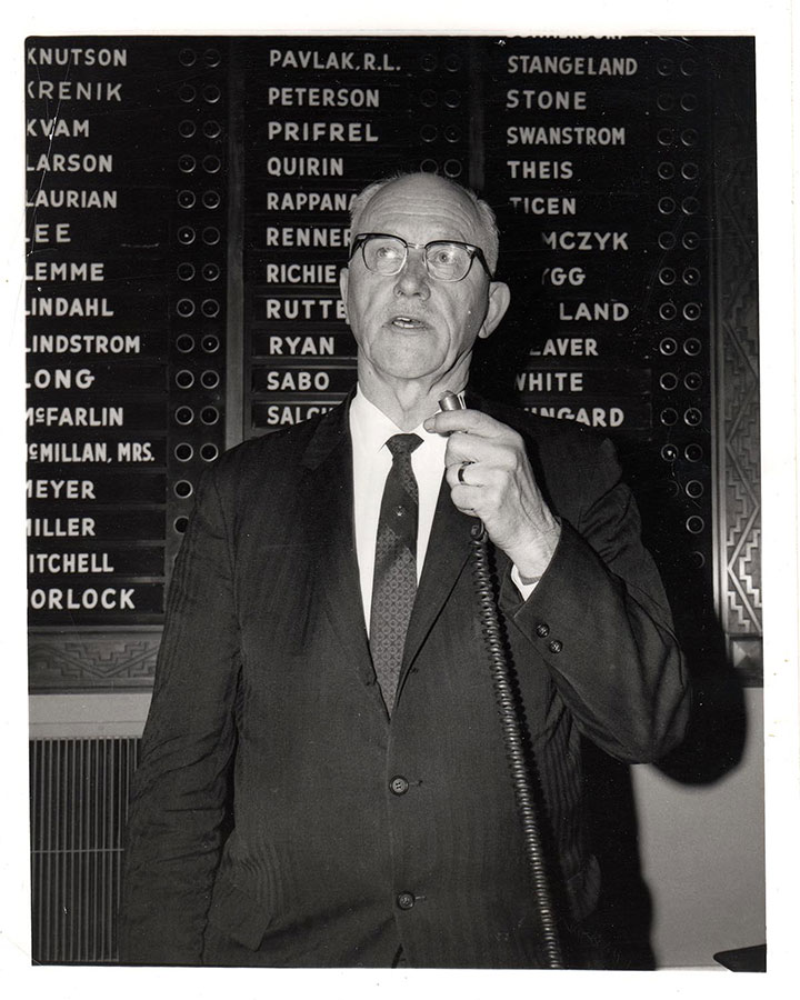
In 1966 Bill was elected to the Minnesota House of Representatives from (the former) District 62 in St. Louis County and served one term. He served on several committees including Forestry and Public Domain, Recreation and Water Resources, and University and College.
Bill’s work on the appraisals began in 1956 and continued until his death in Washington, D.C. in 1971 where he had been testifying on a case. “He finished out his career as a land use consultant and appraiser for natural resources, an expansion of his life-long interest in the forest lands of northern Minnesota.” From the In Memoriam Service, Minnesota House of Representatives delivered by Rep. Douglas Johnson, April 19, 1973.
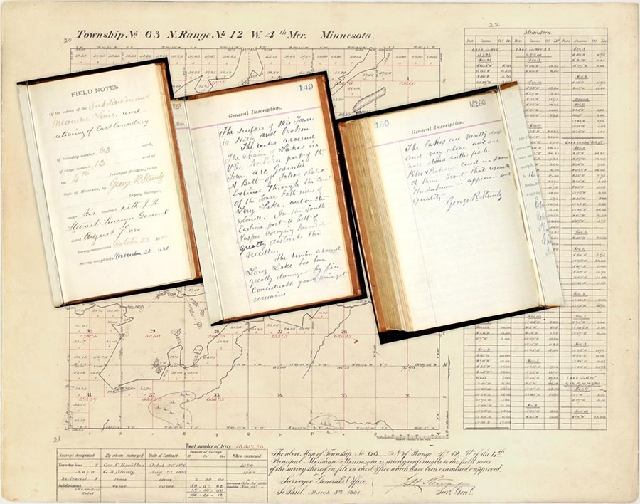
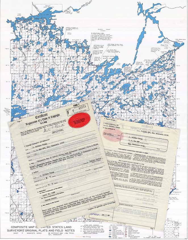
The original land surveyors’ plat maps and field notes provide detailed observations of the land at the time of the surveys. J. William Trygg’s map series “Composite Maps of the United States Land Surveyors’ Plats and Field Notes” was prepared from the surveyors’ records and published and copyrighted in the 1960’s. The maps show the land and water area, also the type of land, that is; swamps, marsh, bottom lands, prairie as indicated on the original survey records. Original pine forests are shown on some of the maps and many maps show the year of the original survey imprinted on each township.
In 2013 Lane Johnson of the University of Wisconsin-Platteville’s Department of Geography contacted Trygg Land Office with his idea to develop a Spring semester project for two senior students, Austin Holland and Ben Matthys, to digitize and georeference the Trygg Composite Maps. Bill’s daughter-in-law Louise Trygg and her daughter Kristen Kidd of Trygg Land Office sent them maps to scan. After digitizing the maps on a large format scanner at Robinson Map Library, UW-Madison, Austin and Ben georeferenced and mosaicked the maps using ArcGIS 10, a Geographic Information System. Lane, Ben, and Austin came to Ely to give a presentation on the digitization project and to learn more about the work that went into developing the map series. Faye Smuk showed the surveyors’ notes on the microfilm reader she used when she worked for Bill in the 1960’s.
Austin and Ben wrote; “The Trygg Composite maps are an irreplaceable source of information related to the historical geography of Minnesota, Wisconsin and Michigan prior to heavy Euro-American settlement. For instance, the paper maps are used by federal land management agencies, state conservation agencies, academics, and independent researchers for ecological and cultural landscape data. The hand drawn maps are also of cartographic interest.”
Trygg Composite Maps are available for purchase at Trygg Land Office.